Map - Mandoul Oriental (Mandoul Oriental)

Mandoul Oriental (Mandoul Oriental)
Mandoul Oriental is one of three departments in Mandoul, a region of Chad. Its capital is Koumra.

 
Map - Mandoul Oriental (Mandoul Oriental)
Map
Openstreetmap - Map - Mandoul Oriental
Openstreetmap
Map - Mandoul Oriental - Esri.WorldImagery
Esri.WorldImagery
Map - Mandoul Oriental - Esri.WorldStreetMap
Esri.WorldStreetMap
Map - Mandoul Oriental - OpenStreetMap.Mapnik
OpenStreetMap.Mapnik
Map - Mandoul Oriental - OpenStreetMap.HOT
OpenStreetMap.HOT
Map - Mandoul Oriental - CartoDB.Positron
CartoDB.Positron
Map - Mandoul Oriental - CartoDB.Voyager
CartoDB.Voyager
Map - Mandoul Oriental - OpenMapSurfer.Roads
OpenMapSurfer.Roads
Map - Mandoul Oriental - Esri.WorldTopoMap
Esri.WorldTopoMap
Map - Mandoul Oriental - Stamen.TonerLite
Stamen.TonerLite
Country - Chad
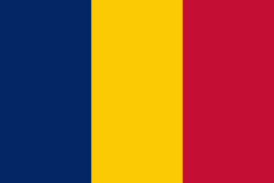
Flag of Chad
Chad, officially the Republic of Chad, is a landlocked country at the crossroads of North and Central Africa. It is bordered by Libya to the north, Sudan to the east, the Central African Republic to the south, Cameroon to the southwest, Nigeria to the southwest (at Lake Chad), and Niger to the west. Chad has a population of 16 million, of which 1.6 million live in the capital and largest city of N'Djamena.

Chad has several regions: a desert zone in the north, an arid Sahelian belt in the centre and a more fertile Sudanian Savanna zone in the south. Lake Chad, after which the country is named, is the second-largest wetland in Africa. Chad's official languages are Arabic and French. It is home to over 200 different ethnic and linguistic groups. Islam (55.1%) and Christianity (41.1%) are the main religions practiced in Chad.
Currency / Language  
ISO Currency Symbol Significant figures
XAF Central African CFA franc Fr 0
Neighbourhood - Country  
  •  Cameroon 
  •  Central African Republic 
  •  Libya 
  •  Niger 
  •  Nigeria 
  •  Sudan